GBIF Downloader for QGIS
Submit and manage GBIF occurrence download requests directly from QGIS. No API knowledge required.
Requirements
- QGIS 3.28 or newer (including QGIS 4.x / Qt 6). Download QGIS
- A free GBIF account. Register at gbif.org
- No additional Python packages required.
Step 1: Install the Plugin
From the QGIS Plugin Repository (easiest)
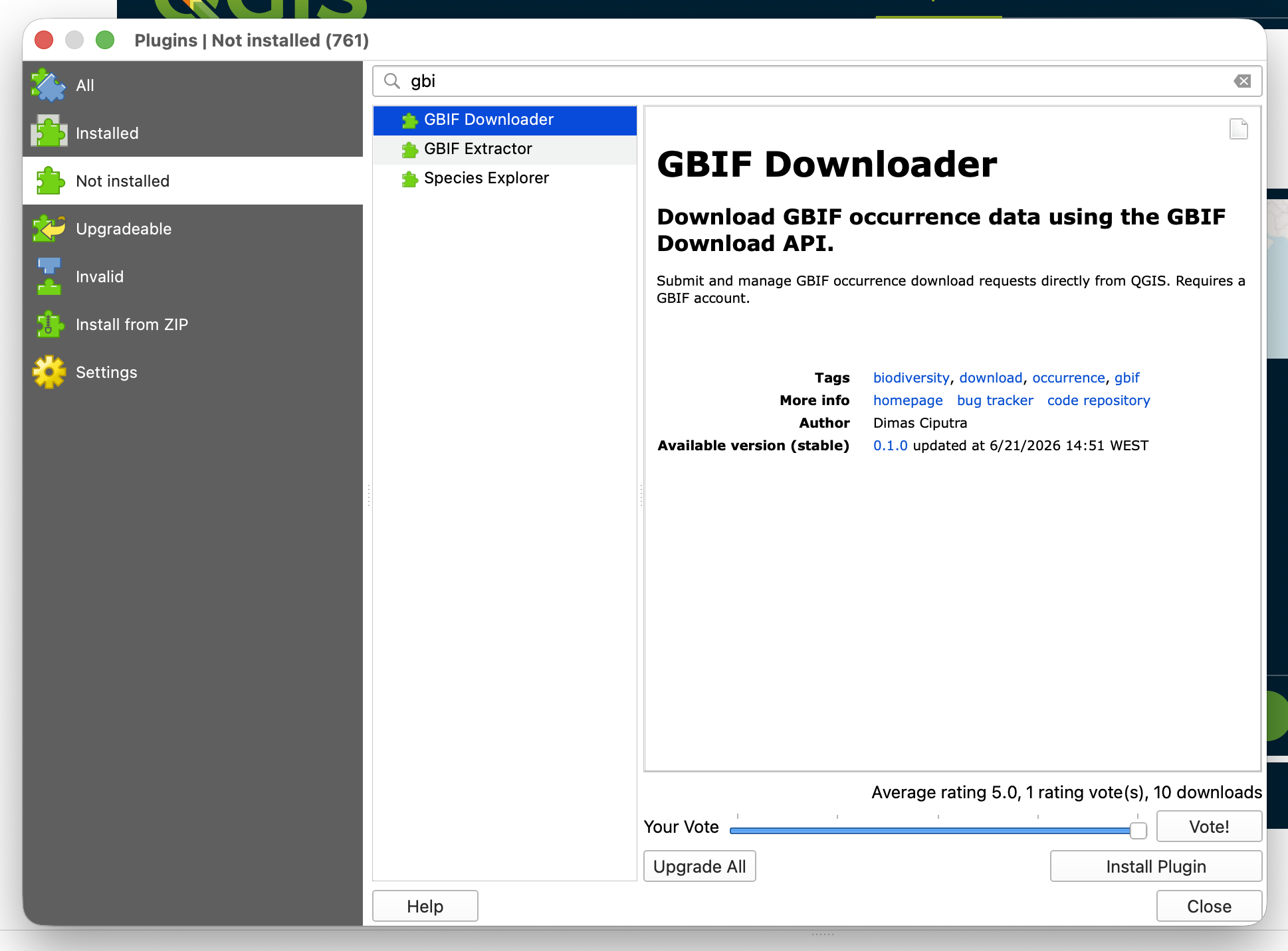
- Open QGIS and go to Plugins > Manage and Install Plugins.
- Search for GBIF Downloader.
- Click Install Plugin.
From a ZIP file
- Download
gbif_downloader.zipfrom the Releases page. - In QGIS: Plugins > Manage and Install Plugins > Install from ZIP.
- Select the downloaded file and click Install Plugin.
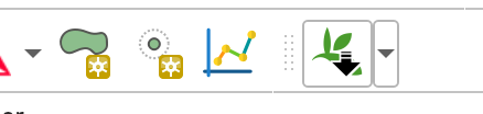
After installation, a GBIF Downloader toolbar button appears. Click it to open the dock panel.
Step 2: Configure GBIF Credentials
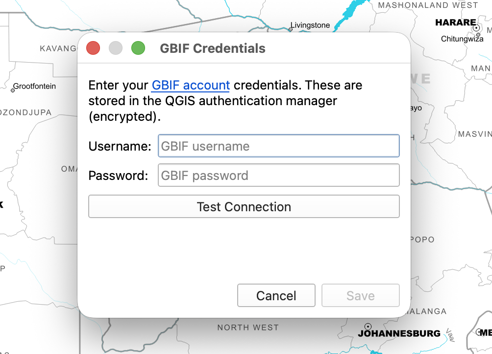
- In the dock panel, click Configure GBIF Credentials (shown when no credentials are set).
- Enter your GBIF username and password.
- Click Save. Credentials are stored securely in the QGIS authentication manager, never in plain text.
Step 3: Build a Query
The Query tab contains collapsible filter sections. Enable any combination of the following:
| Filter | Description |
|---|---|
| Scientific name | Autocomplete search against the GBIF species backbone |
| Dataset / Institution | Limit to a specific GBIF dataset or publishing institution |
| Basis of record | Observation, Preserved specimen, Machine observation, etc. |
| Country | Country of occurrence |
| Year | Exact year, before/after, or year range |
| Month | One or more calendar months |
| Coordinate uncertainty | Maximum or range in metres |
| Elevation | Metres above sea level (range) |
| Conservation status (IUCN) | EX, EW, CR, EN, VU, NT, LC, DD, NE |
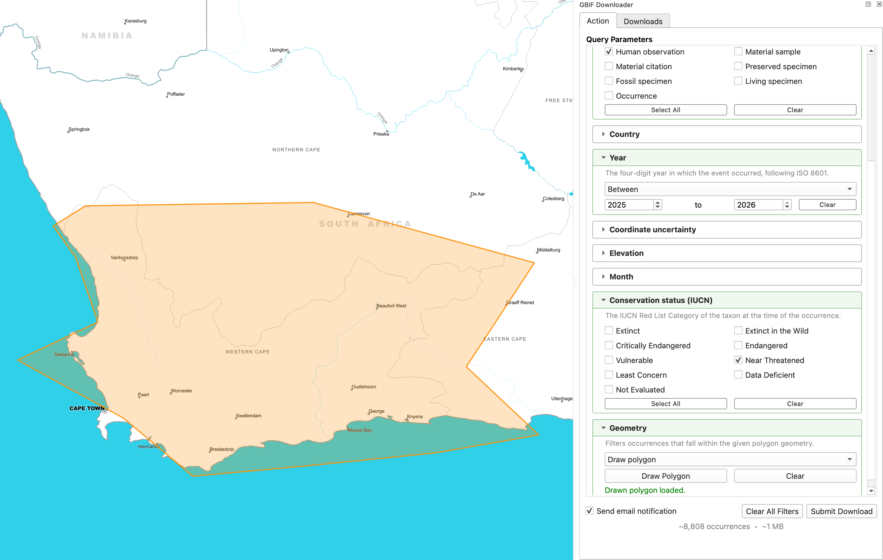
| Geometry | Draw a polygon on the map canvas or use a polygon layer |
Drawing a spatial filter
- Expand the Geometry section and click Draw on map.
- Click on the QGIS map canvas to place polygon vertices over your study area.
- Right-click to finish. The polygon appears on the map and is added to the query.
Tip
The status bar below the filters shows a live count of matching records and the estimated download size, updated automatically as filters change.
Step 4: Submit the Download
- Once satisfied with the query, click Submit Download.
- Review the filter summary in the confirmation dialog.
- Accept the GBIF data use agreement and citation requirements.
- Click OK. The request is sent to the GBIF Download API and a download key is returned.
Info
GBIF processes downloads asynchronously. Small downloads typically complete in under a minute; large ones may take longer. You will receive an email notification when the download is ready, or watch the Downloads tab.
Step 5: Manage Downloads
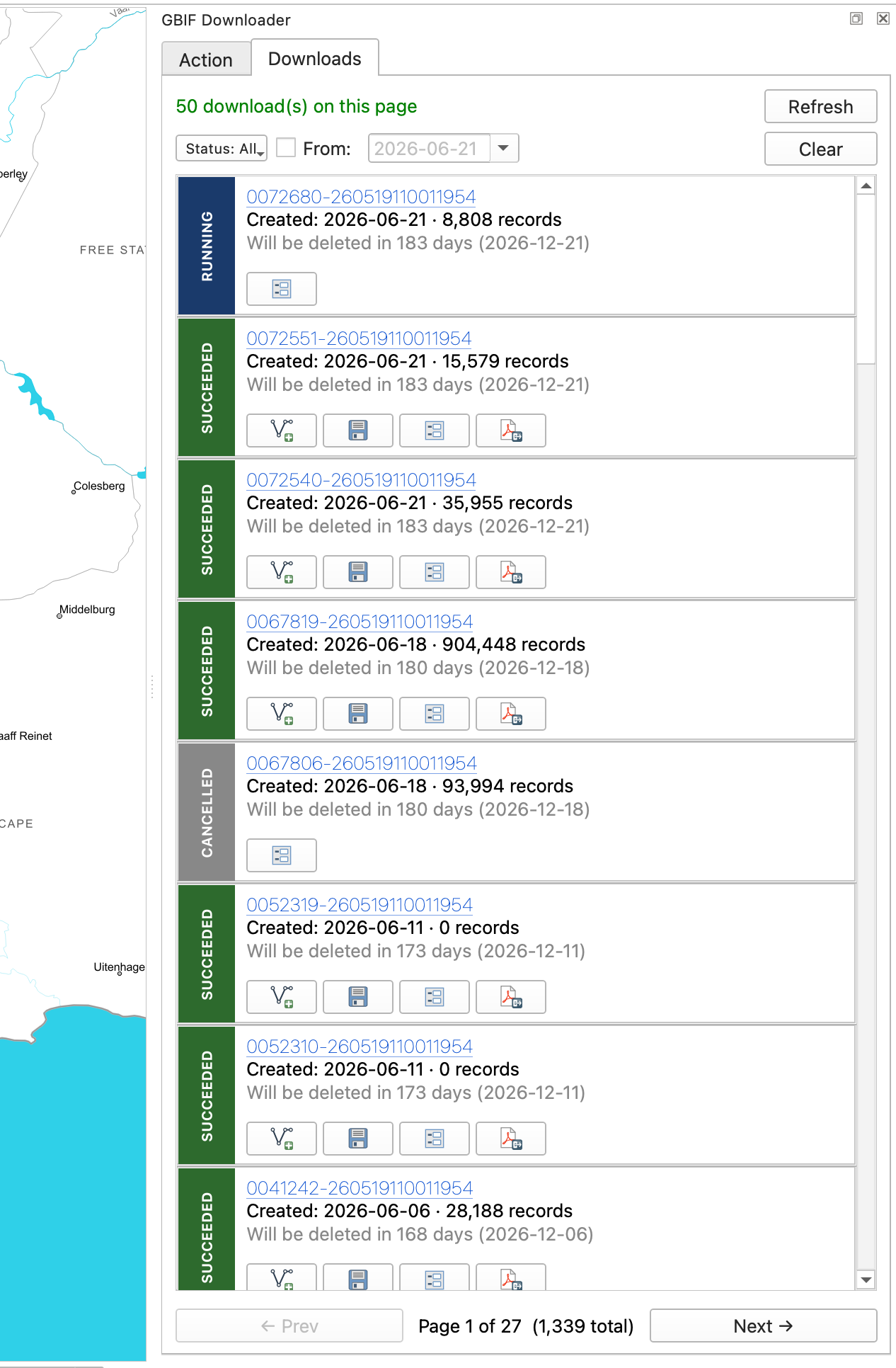
The Downloads tab lists all your GBIF downloads. Pending downloads are polled automatically every minute. No manual refresh needed.
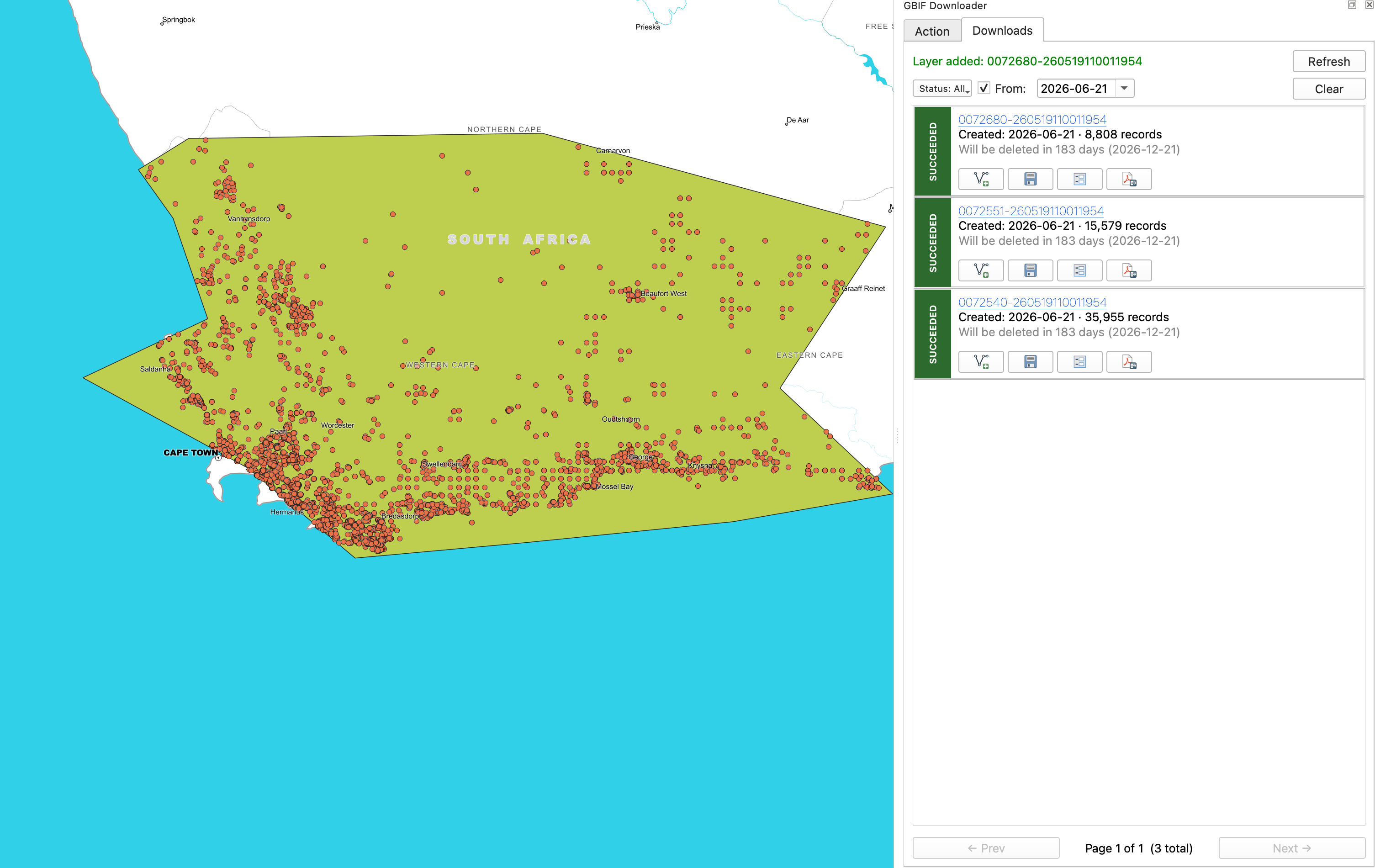
Once a download shows SUCCEEDED, click the action button on the right for options:
- Load as layer - extracts the TSV and adds occurrences directly to the QGIS map, automatically symbolized by IUCN Red List conservation status.
- Save ZIP - saves the full archive to a local cache folder and opens it in the file manager.
- Details - shows full metadata: record count, DOI, licence, expiry date, citation text, and a breakdown of all predicate filters used. Geometry predicates can be loaded back to the map as a layer.
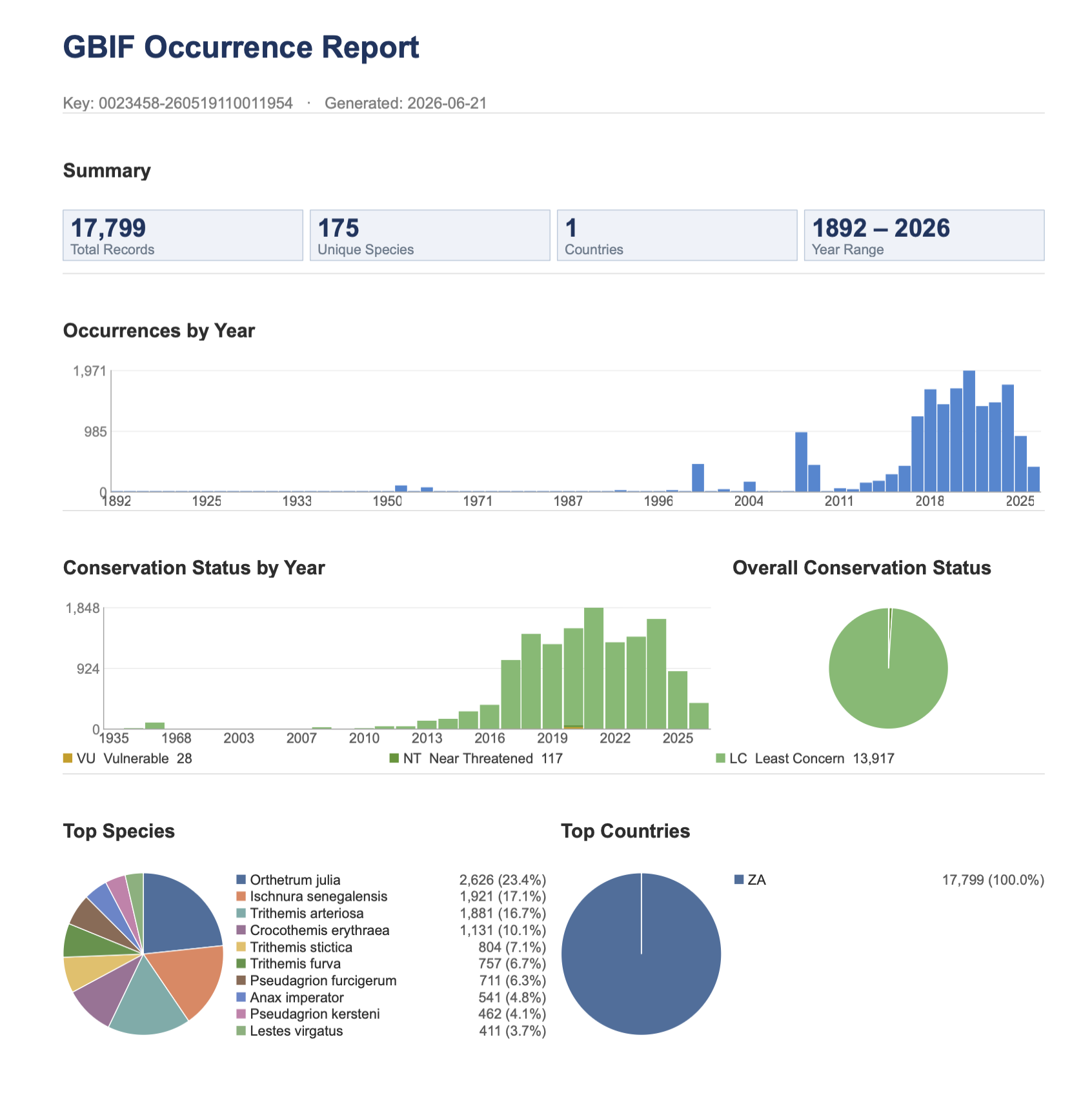
- Report - generates a PDF summary containing statistics, an occurrences-by-year chart, IUCN status charts, and ranked species and country tables.
Step 6: Generate a PDF Report (optional)
- In the Downloads tab, click Report on any completed download.
- The plugin downloads the data if not already cached, parses it, and renders a PDF.
- The folder containing the PDF is opened automatically when complete.
The report includes total records, unique species and country counts, year range, an occurrences-by-year bar chart, IUCN conservation status charts, and top-10 species and country tables.
Source Code and License
The plugin is fully open source, published under the GPLv3 license.
- Repository: github.com/dimasciput/gbif-downloader-qgis-plugin
- Issues and feedback: GitHub Issues